

Day 3 Block Lakes Jnc CG to Sawback Lake CG, 12.1 km, 299 m elevation gain, 200 m elevation loss, 4 hrs 45 min.


This was going to be a very short but hot day. I was up early to take photos plus to just walk around and enjoy the quiet of the morning.


After 30 minutes of taking photos and just being in the place I headed off to the food storage area to make breakfast. The sun was still low on the horizon but had started to peak over the trees as my water came to a boil for my coffee. What timing.

Camp woke up slowly. This was a great trip for relaxing mornings. Long summer days and moderate to short mileage.


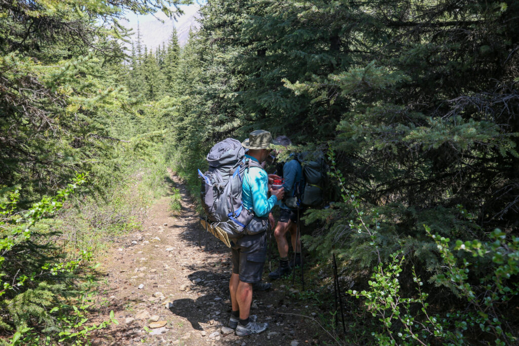
Yesterday we finished the hike on good solid trail and I was expecting more of the same for this day. The trail did not disappoint me. Then 5 minutes later it decided it was time for a practical joke as we found ourselves back in the water.

At first it was just a coupe of small creek crossings but then were back to hiking through the bush to avoided flooded trail.


With the Cascade River flooding the trail we followed a light but distinct path that ran along the bank of the river. Even if there was no path to follow it was the obvious choice to stay close to the original trail. After a few minutes we popped out to a open flooded field and and the path disappeared leaving us with some decisions to make.
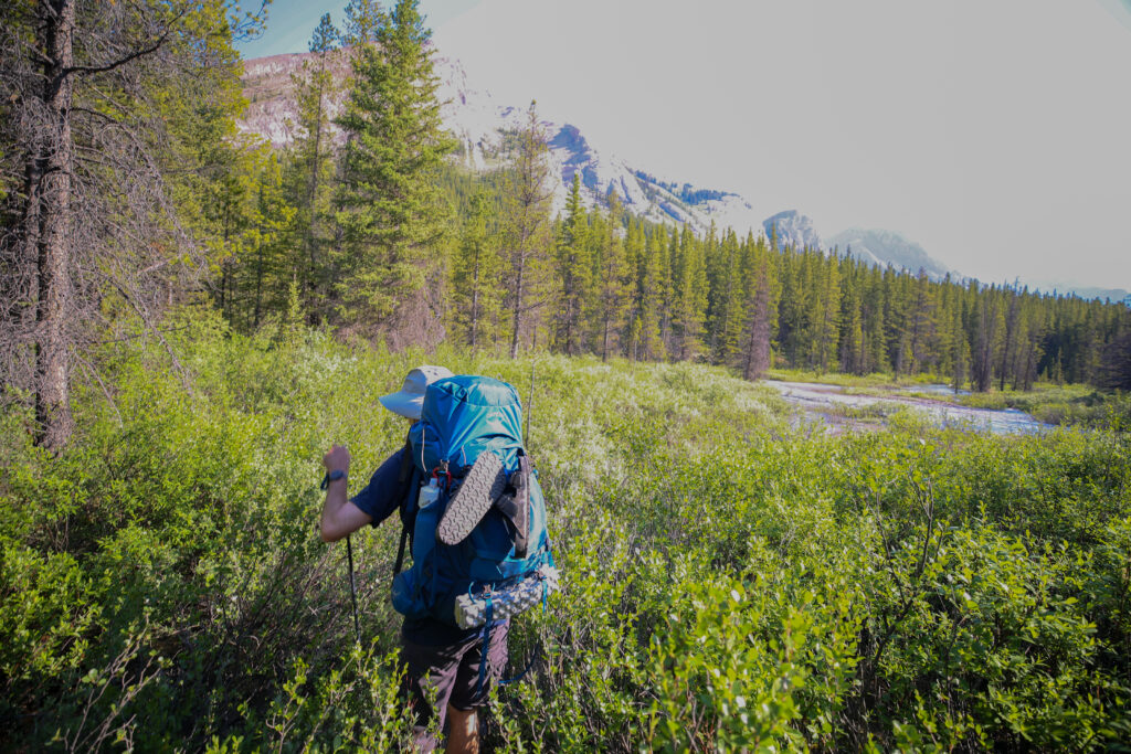

As we searched for a way forward Ken spied some flagging off to the right. To follow the flagging we would have to cross numerous water filed channels to some islands were maybe we find some semblance of trail. Surveying the area I decided our best move would be to make to the west bank of the river. I knew the trail eventually followed the west side of the Cascade River all the way to Flint Park Campground so reasoned it would be good to just head there now. Ken was pretty determined to follow the flagging which was taking us back into the middle of the Cascade River away from solid ground. I will admit I got a little bullish. Instead of have a discussion on what we should do as a group I headed off to make my way to the high ground on the west bank. I ploughed through the soggy willows and soon came to a deep water crossing running right along the west bank. I pushed through the thigh deep water scrambled up the bank on found myself on a trail :). When I turned around I saw the guys were coming my way but they were a little ways behind. They had perhaps hesitated before following me.


If anyone was annoyed at me they didn’t show. I think everyone was pretty happy to see a nice solid trail going in our direction. It had been a very action packed first 25 minutes. The hike to Flints Park would take another 90 minutes and was much more typical for a day on the trail.
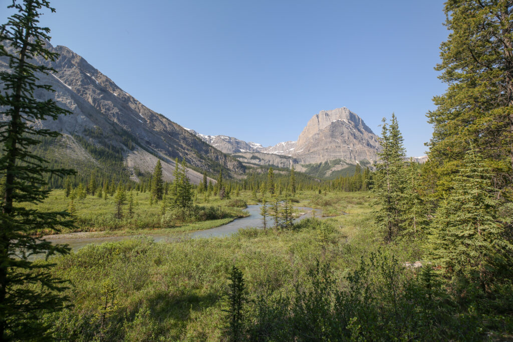


We arrived at the junction for the trail to Sawback Lake and 40 Mile Summit at 10:48 am. Almost exactly 2 hours since we left camp. As we were looking around and taking the expansive view the father and daughter duo we met at lunch on day 1 at Larry’s Camp came by. We said some hellos but not much more than that. We did tell them that there was a lovely path up and over Badger Pass which they appreciated. And just like that they were gone and we along again. We spied the Flint Park Warden cabin a short way passed the sign and decided it was time for an early lunch. The Warden cabin or Patrol Cabin was located on the bank of the Cascade River, complete with an unobstructed view west up the river valley and a shaded picnic table. Perfect.


Lunch was very relaxing and if I remember correctly quite funny. With only 6 km and 170 m of elevation left in our day we were not feeling the need to rush. One concern I did have was that it was not even noon and the day was getting quite hot. We took a little walk around the Wardens Cabin. I regret not taking a picture but the entire front porch was covered in a nail bed to deter animals most likely bears from looking for an easy snack.
I found the name Flints Park to be quite unusual. There is even a Flints Peak. Once back home I looked up online and could find no information. I emailed the Whyte Museum of the Rockies and below is their reply.

I did contact geonames.nrcan.gc.ca, but never got a reply.


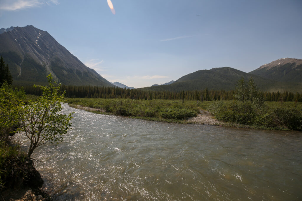
By the time we were back on the trail it had been about 50 minutes since we had first passed by the bridge on our way to lunch.


After crossing the exposed Cascade River Valley the trees closed in providing us with a lovely shaded canopy. The trail then played a little trick on us. On this day of minimal elevation the trail decided to have a sense of humour and head sharply upwards for a few minutes to remind us we are in the mountains.


As we continued down the trail the canopy thinned above us leaving us exposed to the ever increasing heat of the afternoon. We took to taking “shade breaks” every 10 minutes or so to regulate our temperatures.

After 90 minutes on the trail we came to the junction for Sawback Lake leaving us with a little under 1 km left to our campground.


Parks Canada”s concern with whirling disease for hikers is that the parasite can attach itself to clothing or skin and can then travel from one water body to another. Next time on trail I will read the warning bulletins more carefully.


Arriving in before 2 pm at the height of summer is a very early day. Unsurprisingly there was no one else at camp so we had our pick of tent pads. We had to be a little careful as some other camper had brought their horse(s) right into camp and there was horse poop all around but luckily not on the tent pads.
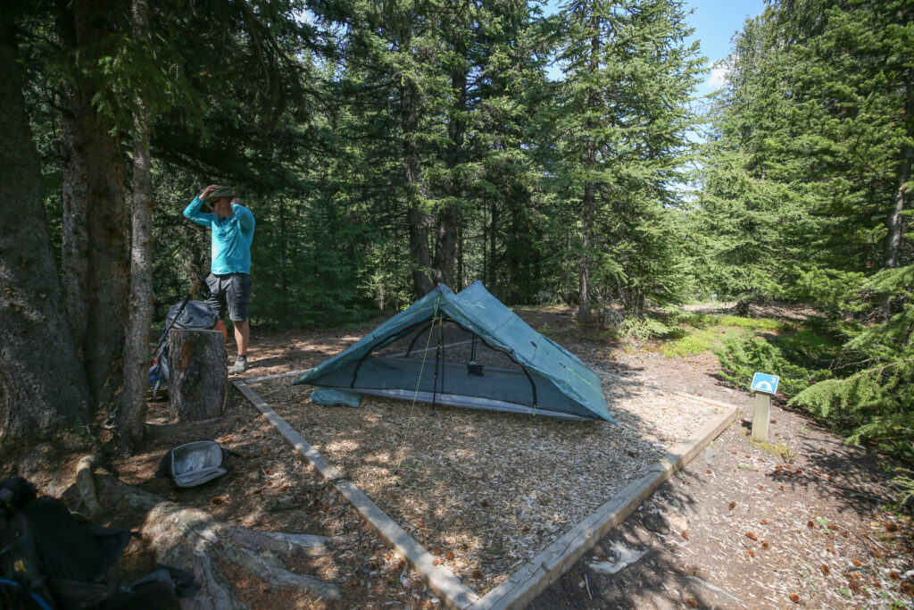
We were keen to go check out Sawback Lake so we put our food in the bear bins provided. This involved quite a little trek across the meadow to wooded area on the far side. I took the opportunity to pre-chill a beer. I ended up taking the beer to Sawback Lake and finished the chilling process there.

At 3 pm we headed off on the 1.4 km hike to Sawback Lake. The trail to the lake is distinct but quite soggy in places. Sawback Lake is framed by mountains on all three sides. What immediately caught my eyes were the shear cliffs of the back bowl. The cliffs form a long continuous ridge that leads up to Noetic Peak off the right side (north) of the picture below.

We set up our “camp” at the north-east end of lake therefore looking south-west on a slightly boggy beach head. One drawback of what was a very nice area to sit and view the lake was that it full sun exposure making it a very hot location to try and sit and relax. I attempted to walk around the north shore to see if there was a other options but the boggy beach really was the best view of the lake.


It was too hot to cook on our little grassy marsh so we moved into the trees just behind where there was a bit of a shaded clearing that we could utilize as our kitchen. The tremendous drawback to our new kitchen was that we had no view. We all cooked our dinners, I filtered water for tomorrow, and then moved back to the grassy marsh to eat with a view of the lake.

We ended up staying at the lake for four hours, only leaving when the sun disappeared behind the mountains.


We had another short day tomorrow complete with another lake. We all went to bed early with both Spencer and I reading until about 10 pm.
Good night from Sawback Lake CG.